
Location of the Lipto County in the Hungarian Kingdom
The county of Lipto is the Conty of the Low Tatry mountains (Nizke Tatry).
Liptov (Slovak:, Hungarian: Liptó, German: Liptau, Polish: Liptów, Latin: Liptovium) is the name of a
historic administrative county (comitatus) of the Kingdom of Hungary. Its territory is presently in northern
Slovakia. Today it is only an informal designation of the corresponding territory.
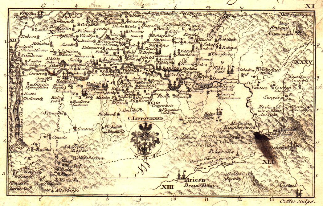
Geography :
Liptov county shared borders with the Austrian land Galicia and the Hungarian counties Árva (Orava), Turóc (Turiec),
Zólyom (Zvolen), Gömör-Kishont (Gemer-Malohont) and Szepes (Spiš). The county's territory was situated along the upper
Váh river between the High Tatras and the Low Tatras. Its area was 2,247 km² around 1910.
Today, the territory of the former Liptov county largely corresponds to the Ružomberok District and Liptovský Mikuláš
District in northern Slovakia. Three villages (Liptovská Teplička, Štrba and Štrbské Pleso) are now in the Poprad District.
Capitals :
The capitals of the county were the Liptov Castle and the villages of Liptovská Mara and Partizánska
Ľupča since 1677 the capital was Liptovský Mikuláš.
History :
Liptov county as a Hungarian comitatus arose before the 15th century. In 1918 (confirmed by the Treaty of Trianon 1920),
Liptov county became part of newly formed Czechoslovakia.
During World War II, when Czechoslovakia was split temporarily, Liptov was part of independent Slovakia. After World
War II Liptov county was in Czechoslovakia again. In 1993, Czechoslovakia was split and Liptov became part of Slovakia.
Demographics :
Population by language (1910 census):